| Layer name | Affected Landcover(GFM) |
| Tag | Flood |
| Folder | Eo Satellite |
| Source | GFM |
| Description |
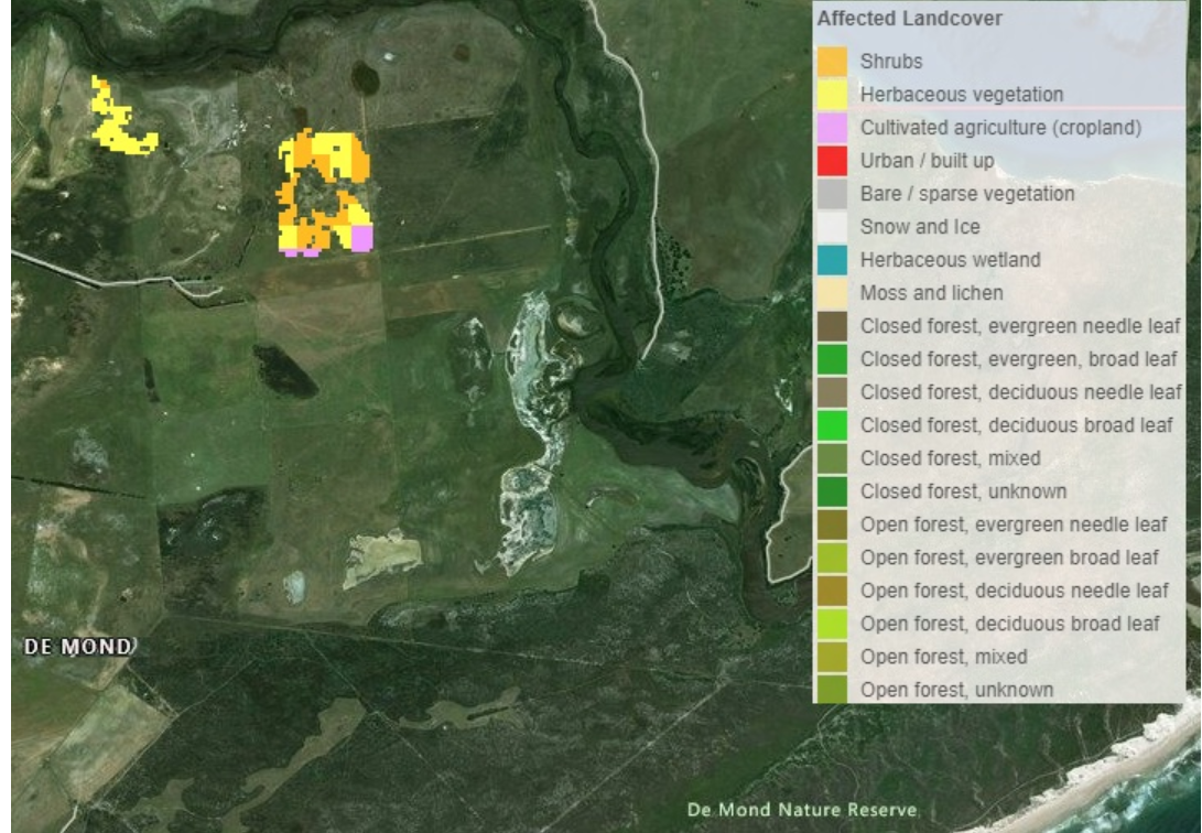
In addition to the affected population, we suggest including information about the Affected Land Cover for a particular flood case. This information can provide a first assessment of affected land cover or land use types, e.g., how much agricultural area is affected by the flood extent. |
| Screenshot |
|
| Properties | |
| Available variables | Affected Landcover |
| Available accumulations | |
| Available interpolation algorithms | |
| Available filters | |
| Spatial aggregations |