| Layer name | VIIRS 5-day composite |
| Tag | Flood |
| Folder | EO Satellite |
| Source | Space Science and Engineering CenterUniversity of Wisconsin-Madison |
| Description |
The VIIRS Composited Flood Products are used to filter out cloud cover through a maximal waterfraction composition process and thus derive the maximal flood extent during a flood event from the VIIRS NRT flood maps of Suomi-NPP and NOAA20. The routinely global VIIRS Composited Flood Products include daily composited flood product and 5-day composited flood product. The compostion process is done by dividing the global land into 136 AOIs. |
| Screenshot |
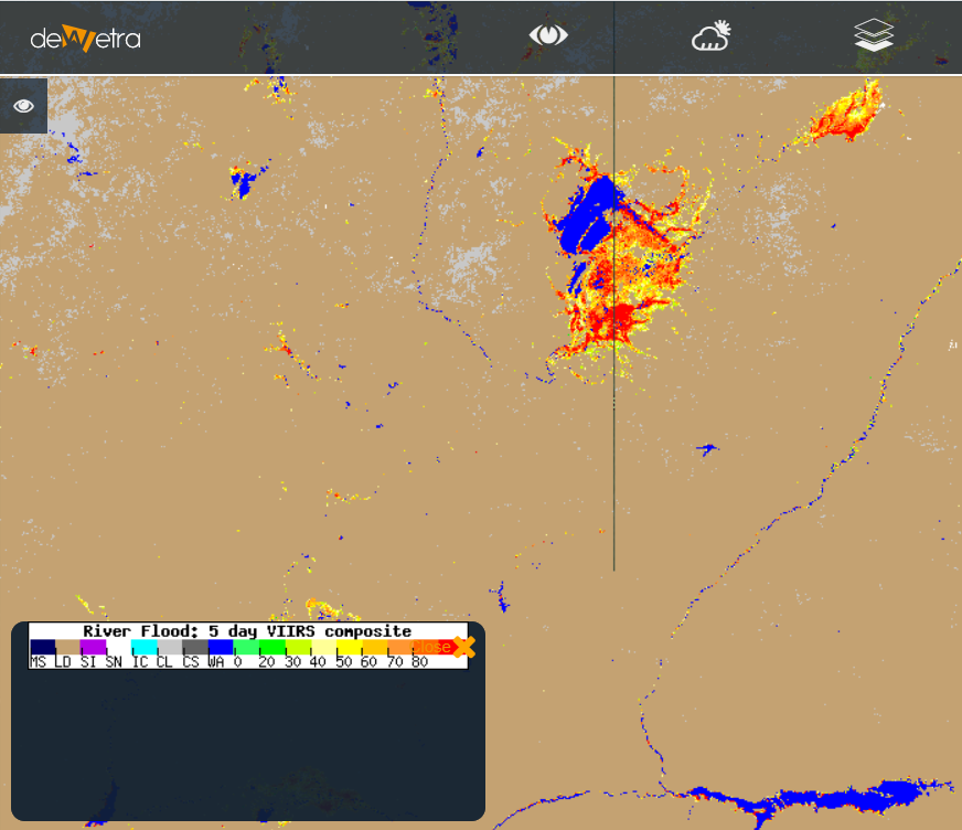
|
| Properties | |
| Available variables | 5-day persistency of flooding |
| Available accumulations | |
| Available interpolation algorithms | |
| Available filters | |
| Spatial aggregations |