| Layer name | VIIRS Flood Depth |
| Tag | Flood |
| Folder | EO Satellite |
| Source | Space Science and Engineering CenterUniversity of Wisconsin-Madison |
| Description |
VIIRS downscaling software is designed to downscale the VIIRS 375-m flood products to 30-m flood products. The software uses Suomi-NPP & NOAA-20 VIIRS floodwater fraction product and the 30-m SRTM/DEM in the CONUS with a series of ancillary datasets including SRTM Water Body Dataset (SWBD), 30-m CONUS Land Cover Dataset, 30-m CONUS Canopy Dataset, and NHDPlus Version 2 river lines and water shed datasets to derive the vertical inundation information. The process is done based on each level-4 hydrologic unit (HUC-4) and the final outputs cover the flooded regions with 30-m floodwater depth |
| Screenshot |
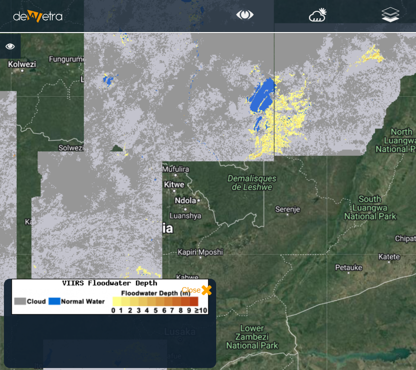
|
| Properties | |
| Available variables | Flood water depth |
| Available accumulations | |
| Available interpolation algorithms | |
| Available filters | |
| Spatial aggregations |