[Home] - [Platform Access] - [Admin] - [DDS Config Manager] - [Bulletin: Bulletin Management and Custom Bulletin Editor] - [User Interface and Available Tools] - [Static Layers] -[Observations] - [Forecast Models] - [Events]
The Observation menu is the first action button in the toolbar and provides access to all observational datasets available in the system.
When the user clicks the button, a window opens displaying filters at the top and the list of layers at the bottom.
Three filters are available to refine the search for the desired layer: Coverage Filter, Hazard Picker, and Layer Search.

¶ Filters
- Coverage Filter allows the user to select layers based on a specific geographical extent. By default, all coverages are selected.
The image below is an example of a list of available coverages, but it may vary depending on the user type.

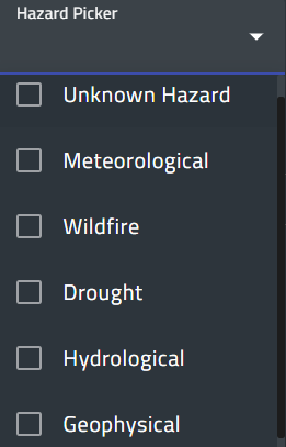
- Hazard Picker allows the user to display only layers related to one or more hazards. The lists of hazards may vary depending on the user profile. By default, all hazards are selected.
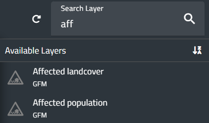
- Search Layer allows the user to search for layer by typing its name or part of it.
This filter works only within the tags currently selected, not on the whole available datasets.
¶ Layer list
In the bottom part of the window, the list of available layers is shown:
- on the left, the list of selectable tags.
- on the right, the layers associated with each tag.
The table below shows the available layers on the CIMH configuration of myDewetra3. However, the list of layers may vary depending on the user profile.
More information about each layer can be accessed by clicking on its name.
| Tag | Layer |
| Warnings | Alerts |
| Rain | IMERG Early |
| GSMaP | |
| GSMaP Real Time | |
| Rain Map | |
| RADAR MOSAIC | |
| SATMWIR-SRI | |
| SATMWIR-SRT | |
| Fire | MODIS Hotspots |
| Drought | SPEI |
| Soil Moisture | RZSM-ASCAT-NRT-10 (H26) |
| SSM-ASCAT-NRT-(H122) | |
| Cloud Cover | MSG IR 10.8 |
| Floods | Advisory Flags (GFM) |
| Affected Landcover (GFM) | |
| Affected Population (GFM) | |
| Exclusion Mask (GFM) | |
| Observed Flood Extent (GFM) | |
| Observed Water Extent (GFM) | |
| Reference Water Mask (GFM) | |
| Uncertainty Values (GFM) |
¶ Loaded layers
When a layer is loaded, it is automatically added to both the Control Map and the Layer List (top left corner of the screen).
While the layer is visible in the Control Map, the Layer List provides additional information and access to specific functions.

¶ Information displayed
For each loaded layer, the system displays:
- Layer name
- Reference date,
- Initialization time (for model outputs),
- Temporal aggregation (if available).
¶ Layer ordering
To the left of the layer name, an icon with six dots allows the user to drag the layer up or down within the list.
The order of layers in the list determines their display order on the map: the topmost layer in the list appears on top of the map.
¶ Available functions
To the right of the layer name, several buttons provide access to specific functions:
- Hide layer: temporarily hides the layer without deleting it from the list. Pressing the button again restores its visibility on the map.
- Remove layer (trash-can icon): removes the layer from the list.
- Layer details (i icon): opens a window displaying metadata and additional information.
- Zoom to Layer: sets the zoom back to the default extent of the selected layer.
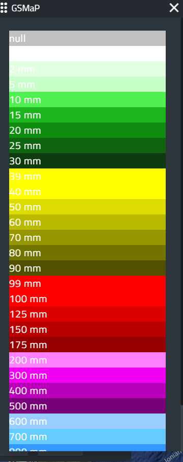
- Legend: displays a pop-up window showing the legend associated with the layer.
The image below shows the legend for the GSMaP layer, as an example.
- Properties: opens a window where users can modify parameters such as variables, cumulative range, spatial aggregation, and reference date. The available options depend on the characteristics of the selected layer. Users can modify all parameters in order to change the data visualization on the map.
The image below shows the properties of the GSMaP layer, as an example:

- Expand option displays additional buttons that provide access to functions such as:
1. the slider to adjust the transparency/opacity of each layer
2. the metadata button allows the user to view the metadata file associated with the layer
3. the download button saves the selected layer to the user’s local disk in various formats
- For certain layers, additional controls appear below the layer name: Play/Pause, Rewind, and Fast Forward buttons.
These buttons allow navigation through the time series associated with the layer (forward to the next entry or backward to the previous one), if available. - By left-clicking the layer name, users can reopen the Properties window to edit the parameters of the loaded dynamic layer. Depending on the dataset, parameters may include: spatial aggregation, accumulation period (for cumulative variables), time step, threshold values for data filtering, interpolation algorithm (if the variable is interpolated), and other other settings.
[Home] - [Access to the platform] - [User Interface] - [Observations] - [Forecast Models] - [Static Layers] - [Events]